
Beginning spatial with SQL server 2008
by Alastair AitchisonMicrosoft SQL Server 2008 introduces new geography and geometry spatial datatypes that enable the storage of structured data describing the shape and position of objects in space.
This is an interesting and exciting new feature, with many potentially usef.
- First published
- 2009
- Publishers
- Apress
- Subjects
- Sql server·Database management·Spatial analysis
If you are exploring the Geography or Geometry data types in SQL Server then this is THE book to get. I work for a large oil and gas company and using these types of data has allowed our sub-surface exploration group to do some amazing visualizations!
The book provides a good introduction to spatial data and the specifics of working with it in the context. It extends to providing examples of ONE-WAY web apps with GoogleMaps and VirtualEarth, to offer read-only spatial data to browsers.
If you are travelling into the SQL Server Spatial world, this is a good companion. I have found some very useful code I could use in my application in this book.
Books

Into the Remote Places
Alastair Farquharson
Trusts of Homes
Alastair Hudson
Ownership of the family home is generally not contested until the relationship between the spouses or cohabitants breaks down.
Alien Pit Stop
Alastair Cairns
Special Messenger
Alastair Hannay
School Story
David Aitchison
Multiracism
Alastair Bonnett

Aids to Forensic Medicine and Toxicology
W G Aitchison Robertson
Fore a magistrate, technically known as the 'beak, ' who, in addition to being a person of great acumen, is a stipendiary, and thus occupies a superior position to the ordinary 'j.
Hospitality and Travel Marketing
Alastair M. Morrison
Locomotion
Alastair Steele
Hospitality and Travel Marketing
Alastair M. Morrison

Eversion
Alastair Reynolds
Thomas Mackay
Alastair Sweeny

Tokyo Story
Alastair Phillips
From West to North Frisia
Alastair Walker
Tourism Marketing
Alastair M. Morrison
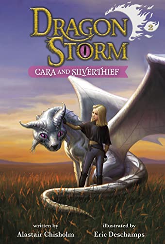
Dragon Storm #2
Alastair Chisholm

School Story
David Aitchison
Dragon Storm 6-Copy Clip Strip Fall 2022
Alastair Chisholm

Eversion
Alastair Reynolds

No Peeking At Presents
Alastair Heim

Dragon Storm #3
Alastair Chisholm
Tourism Marketing
Alastair M. Morrison

Dragon Storm #3
Alastair Chisholm
Hello, Tree
Alastair Heim
Tale of the Valiant Ninja Frog
Alastair Chisholm
4 Futures Journal
Alastair Macdonald
Head First
Alastair Santhouse
Equity and Trusts
Alastair Hudson
Understanding Equity and Trusts
Alastair Hudson
Fire in Paradise
Alastair Gee

Aids to Forensic Medicine and Toxicology
W. Aitchison
What is investing?
Alastair Dorsett
Gauge Theories in Particle Physics
Ian J. R. Aitchison

Adam-2
Alastair Chisholm
With incredible twists and turns and an action-packed story, this is a thrilling, unputdownable adventure.

Critical Applied Linguistics
Alastair Pennycook

'All Manner of Industry and Ingenuity'
Alastair Compston

Chronicle of First Broadcast Performances of Musical Works in the United Kingdom, 1923-1996
Alastair Mitchell
This title was first published in 2001.


Belladonna Nights and Other Stories
Alastair Reynolds

Age of Islands
Alastair Bonnett
Equity and Trusts
Alastair Hudson

World Tourism Cities
Alastair M. Morrison

South West Coast Path Log Book
Alastair Papworth

Rendezvous
Alastair MacNeill
Based on a short story by alistair maclean, rendezvous conjures up the darkest days of the war in the mediterranean, and the nail-biting drama of a secret life haunted by the fear of betrayal and capture.

Terminal World
Alastair Reynolds
In the last surviving human city, an ex-spy gets sucked into a dangerous quest that will take him beyond the city walls when a winged man turns up dead in his morgue in this innovative and original dystopian space adventure.

Immeasurable Wilds
Alastair Mitchell
Sign Says Stop!
Alastair Heim
Principles of Equity and Trusts
Alastair Hudson
Pacific Crest Trail Log Book
Alastair Papworth


Equity and Trusts
Alastair Hudson
Alastair hudson's equity and trusts is an ideal textbook for undergraduate courses on the law of trusts and equitable remedies.
Cutting Edge Advertising
Jim Aitchison
World Tourism Cities
Alastair M. Morrison
Critical Applied Linguistics
Alastair Pennycook

Thames Path Walk Log Book
Alastair Papworth
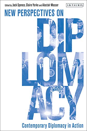
New Perspectives on Diplomacy
Alastair Masser
Effective diplomacy remains fundamental to the conduct of international relations in the twenty-first century, as we seek to define and manage a challenging new world order peacefully.
Principles of Equity and Trusts
Alastair Hudson
Tourism Policy, Planning and Development
Alastair Morrison
This new textbook offers students a comprehensive but engaging overview of tourism planning from a worldwide viewpoint, by covering tourism policy, planning and development in one volume.
Similar books
Microsoft SQL Server 2005 Express
Don Jones


Professional Microsoft SQL Server 2016 Reporting Services and Mobile Reports
Paul Turley
Describes the architecture and bi fundamentals of microsoft sql server 2016 reporting services, covering such topics as report design, advanced queries and parameters, expressions and actions, solution patterns, and server administration..
NoSQL
Ganesh Chandra Deka

Business Intelligence with SQL Server Reporting Services
Adam Aspin
Business intelligence with sql server reporting services helps you deliver business intelligence with panache.
MySQL
Paul DuBois

Pro Oracle SQL
Karen Morton
Pro oracle sql, second edition unlocks the power of sql in the oracle database?
PROC SQL
Kirk Paul Lafler

Professional Microsoft SQL Server 2012 Reporting Services
Paul Turley
A must-have guide for the latest updates to the new release of reporting services sql server reporting services allows you to create reports and business intelligence (bi) solutions.

Professional Microsoft SQL Server 2012 Administration
Adam Jorgensen
An essential how-to guide for experienced dbas on the most significant product release since 2005!
Professional Microsoft SQL Server 2012 Administration
Adam Jorgensen
An essential how-to guide for experienced dbas on the most significant product release since 2005!

Sams teach yourself SQL in 24 hours
Ryan K. Stephens
In just 24 sessions of one hour or less, you'll learn how to use sql to build effective databases, efficiently retrieve your data, and manage everything from performance to security!
SQL server DMVs in action
Ian W. Stirk

Pro SQL Server 2008 Service Broker
Klaus Aschenbrenner
Now available in paperback-- service broker is a key microsoft product in support of message-based processing between applications.
SQL wait stats Joes 2 pros®
Pinal Dave

Microsoft SQL Server 2008 All-In-One Desk Reference for Dummies
Robert D. Schneider
If you're in charge of database administration, developing database software, or looking for database solutions for your company, microsoft sql server 2008 all-in-one desk reference for dummies can help you get a handle on this extremely popular re.
Expert SQL Server 2005 Integration Services
Brian Knight
As a practical guide for integration services etl development, this book shows you ways to implement your etl solution requirements from the data to the administration and everything in-between.
Data Analysis Using SQL and Excel
Gordon S. Linoff
Useful business analysis requires you to effectively transform data into actionable information.
Microsoft SQL Server Reporting Services Recipes
Paul Turley
Learn to design more effective and sophisticated business reportswhile most users of sql server reporting services are now comfortable designing and building simple reports, business today demands increasingly complex reporting.

Joe Celko's SQL for Smarties
Joe Celko
"sql for smarties" was hailed as the first book devoted explicitly to the advanced techniques needed to transform an experienced sql programmer into an expert.

MySQL admin cookbook
Daniel Schneller
This book uses the approach of a cookbook, presenting solutions to problems in the form of recipes.

Pro SQL Azure
Scott Klein
Sql azure represents microsoft's cloud-based delivery of its enterprise-caliber, sql server database management system (formerly under the code name "oslo").

Beginning Oracle SQL
Lex de Haan
Beginning oracle sql is your introduction to the interactive query tools and specific dialect of sql used with oracle database.

Microsoft SQL server 2008 bible
Paul Nielsen
Harness the power of sql server, microsoft's high-performance database and data analysis software package, by accesing everything you need to know in microsoft sql server 2008 bible.
SQL and relational theory
C. J. Date
Understanding sql's underlying theory is the best way to guarantee that your sql code is correct and your database schema is robust and maintainable.

Expert SQL server 2008 encryption
Michael Coles
Every day, organizations large and small fall victim to attacks on their data.
Ultra-Fast ASP. NET
Rick Kiessig

Beginning SQL server 2008 administration
Robert E. Walters
Beginning sql server 2008 administration is essential for anyone wishing to learn about implementing and managing sql server 2008 database.
SQL and Relational Theory
C. J. Date
Understanding sql's underlying theory is the best way to guarantee that your sql code is correct and your database schema is robust and maintainable.


Programming Microsoft SQL Server 2008
Leonard Lobel
Extend your programming skills with a comprehensive study of the key features of sql server 2008.
Advanced Oracle SQL programming
Laurent Schneider


MCTS SQL Server 2005
Tom Carpenter
PHP/MySQL avec Dreamweaver 8
Jean-Marie Defrance

PHP & MySQL pour les nuls
Janet Valade
Guru's Guide to Transact-SQL
Ken Henderson

Learning SQL
Alan Beaulieu
Sql (structured query language) is a standard programming language for generating, manipulating, and retrieving information from a relational database.
Learning SQL
Alan Beaulieu
Sql (structured query language) is a standard programming language for generating, manipulating, and retrieving information from a relational database.
Microsoft SQL Server 2005 administrator's pocket consultant
William R. Stanek
Professional SQL Server 2000 Programming
Robert Vieira


Oracle XSQL
Michael D. Thomas
Presents a complete approach to building xml web applications and web services with xsql, oracle text, sql, xslt, and java from data found in oracle databases offers expert tips on how to enhance xsql with servlets and java server pages (jsp) provides a d.

Transact-SQL Cookbook
Ales Spetic
This unique cookbook contains a wealth of solutions to problems that sql programmers face all the time.
SQL in 21 Tagen
Ryan K. Stephens

Sams teach yourself SQL in 24 hours
Ronald R. Plew
Presents a tutorial in 24 sessions of one hour or less, for those with little or no experience of sql.
SQL Server 7 Database Design Study Guide
New Riders Development Group Staff

Oracle PL/SQL Language Pocket Reference
Steven Feuerstein
This pocket reference provides quick-reference information that will help you use oracle's pl/sql language.

Oracle PL/SQL programming
Steven Feuerstein
Oracle is the most popular database management system in use today, and pl/sql plays a pivotal role in current and projected oracle products and applications.